So when last we posted about our epic adventure we were in St. Peter Port planning to leave for an anchorage off Sark (having changed all the travel plans for the end of the week!).
We set out from St. Peter Port as soon as there was 2m of water over the cill and motored out of the harbour. To our utter delight and amazement we were immediately surrounded by a pod of dolphins swimming ahead, under and alongside the boat. It was magical but despite shooting off over a hundred photos we failed to get one single pic with a dolphin in it!
After a few hundred yards the dolphins left us and swam back to repeat the performance with the next boat to leave the harbour and we headed on towards the Muse Passage that cuts through the outlying rocks to the South of Herm.
The wind was more Easterly than forecast, what there was of it, and the seas were calm with just the usual Southerly swell (which seems to be a nigh permanent feature of the waters in the Channel Islands) so we decided to head for Havre Gosselin and try for one of the buoys we'd failed to get on last week.
After some very careful navigsation and helming to counter the strange tidal offsets (you go from being set off course by upwards of 40 degrees to Port to being set off course by 30 or more degress to Starboard three quarters of the way across for no apparent reason) we arrived at the moorings to find the two outer buoys available. Happy days!

Getting on a buoy meant we could go ashore right away - at anchor I won't go out of sight of the boat until we've been through a tidal cycle and I'm confident the anchor isn't going to drag. We'd inflated all bar the bow chamber of the dinghy and carried it on deck so all we had to do was blow that up, launch the dinghy and crane the outboard on.
The previous week, we'd used the borrowed Mariner 3.5 4 stroke outboard but we'd found it was a bit heavy for the (also borrowed) roundtail dinghy. So I dug the venerable old Tohatsu 2.5 2 stroke out of the locker and tried that. Last year it had been a bit unreliable but I'd given it a burn and a dose of nice clean petrol and it started well. It continued to run well, starting on the first pull of the cord, for the next two days (but it would go back to it's recalcitrant ways later as I shall describe in the next installment).

We were then faced with the climb up from the harbour to the top of the cliffs. It's not as precipitous and rough as the climb up from the beach to La Coupee but it's longer with more steps! 299 of them to be precise (according to the pilot book, we were in no fit state to count).
It's a pleasant walk along leafy tracks past occasional cottages and farmsteads to get to the main drag of cafes and tourist tat shops called The Avenue.
We had a nice wander, a beer or two and made our way back to the boat by early evening and those 299 steps again!
 The next morning (Tuesday) we set off ashore again at a reasonable hour with plans for a whole day ashore. It was Jane's 21st birthday (again) so we chose Hathaways at La Seigneurie for a birthday lunch. Not too expensive, although not cheap, but very very good indeed. I greatly enjoyed a particulary fine bottled brew from the Sark micro-brewery called "Dark Monk". Something akin to a cross between a brown ale and a porter is the best description I can manage and it was lush! Sadly, it's only available on the island and none was to be had at the time.
That was followed by a walk around the very nice gardens.
Then it was back towards the Avenue and down to the harbours. There are two next door to each other. Creux harbour is the original drying harbour, thought to have been established by the 16th century settlers from Jersey who repopulated the then uninhabited island. Messeline Harbour was built in relatively modern times to provide all tide access for the island ferry and it now caters for the day visitors coming over from Guernsey.
To be honest, the walk down to the harbours, and particularly the walk back up the long steep hill, was a step too far and not really worth the effort. It left both Maire and I nursing painful knees which required the application of a liberal quantity of medicinal alcohol (best applied internally) when we got back to the top of the hill and staggered into the Bel Air Inn!
Back to the boat for a light tea and an early night after a fabulous day ashore. Sark is deservedly often called the jewel of the Channel Islands and with its unmade roads and complete absence of cars it's a real step back in time. There's a surprising amount to do and see and we by no means did and saw all of it.
We'd been fairly comfortable the first night on the buoy, a little bit of rolling around but nothing too much to handle, but the conditions changed (inexplicably but I've come to the conclusion that nobody really understands the seas around the islands) and within fifteen minutes of retiring to bed Jane and I were baling out of our cabin and setting up the pull out double in the saloon.
There was simply too much random motion and noise up forward (Maire seemed to suffer less in the aft cabin and managed an OK night's sleep) but close to the centre of motion in the saloon we slept fine. No point in being martyrs after all.
That up our minds made and we decided to go with the plan for the rest of the week that involved heading up to Beaucette Marina for a few days. The entrance into the marina is, like St. Peter Port, over a tidal cill but whereas St. Peter Port has a waiting pontoon in the outer harbour, at Beaucette there are a couple of buoys amidst a rock strewn area of shoals! So I planned our departure in order to arrive with the tide, which also meant (in theory at least) a fair tide or at worst a cross tide all the way there.

For a couple of hours on the leg across from Brecqhou to the Muse Passage we even managed to get the sails up and turn the motor off! That would prove to be the only time in the entire fortnight that the big white flappy things would get used. As we approached the passage, the wind dropped to the point where we couldn't make enough boat speed to counter the cross tide and we had to go back onto the motor for the rest of the trip.
The approach to Beaucette is not for the faint hearted!...

I willfully rejected the approach vector shown on the chart in favour of passing to the North of Grune Pierre, a drying rock, as I could see swirls and eddies on the marked approach that suggested some interesting stuff happening below the water. Our timing was spot on to go straight in and we were given a good berth which did involve backing Pagan in as we'd been told (for whatever reason) to go port side too. There was acres of space so I was quite happy to give it a go and it went off without a hitch.
 Beaucette is as different from St. Peter Port as it possibly could be. Small, intimate and sheltered, it has none of the vibrancy, life and, let's be honest, noise, of it's bigger "rival" but it has peace, tranquility and charm by the bucket load.
The Restaurant at Beaucette is one of the most highly regarded in Guernsey and therefore very popular with locals and visitors alike so we booked a table for the following evening soon after we arrived (we'd have preferred Friday but that and Saturday were already fully booked).
The rest of the day, and the following day (Wednesday and Thursday) were spent in idle idleness before donning frocks and trousers (per choice and gender preference) for an superb meal ashore (nominally Jane's birthday dinner, albeit a few days late!). The prices are sensible for fine dining and the food fully justifies the price. Highly recommended if you're ever that way.
Come Friday and Jane and I planned a long walk around the headland to L'Ancresse Bay and L'Ancresse Common. The best preserved neolithic monuments on the island are to be found between the fairways of the Royal Guernsey Golf Club (there's no problem with access, it's public land, it just pays to watch out for flying golf balls!).
Maire had baled on the day as her knee was still giving grief so she elected to spend a day in the shade of the cockpit tent reading.
We set off with our expedition backpacks loaded down with water, cans of coke and snacks. The water and coke were in a cool bag with the fridge block and that successfully kept them cool until it all ran out and we had to resupply at a handy shop half way through the afternoon. It was seriously hot weather and keeping hydrated was essential.
We visited Fort Doyle and headed towards Fort le Plomb. Both of these Napoleonic era forts are accessible by the public at no charge. They are small but interesting, not least because of the adaptations the Germans made during their occupation of the islands.
 Then it was on to L'Ancresse Bay
 The bay is beautiful (its the Channel Islands, it's bound to be!) and surprisingly quiet.
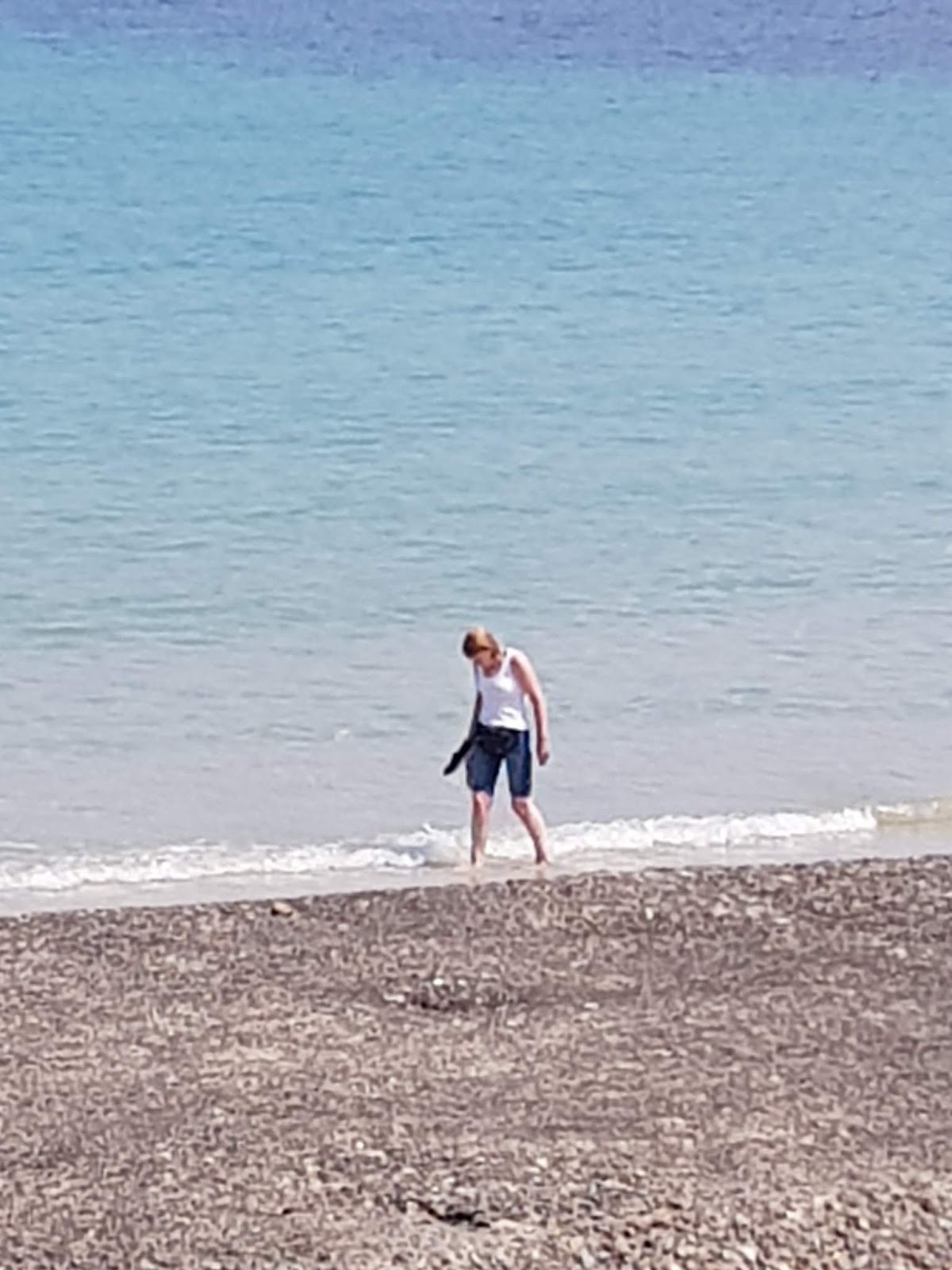
We had an ice cream and then Jane went for a paddle to cool off her feet ...
On we trogged in the hot sunshine, it's a chore but it has to be done, to explore the prehistoric wonders hidden in the undergrowth of L'Ancresse Common.
The hidden delights were indeed well hidden and it took some time of wandering around before we all but stumbled upon the first objective.
This was La Varde, a neolithic passage grave (a.k.a. dolmen) that dates back at least 6,000 years. In it were found both burnt and unburnt human remains in at least two seperate phases.

 The site is open and you can walk in without hindrance.
The passage is fairly simple as such things go but it is quite large.
Buried under the golf course landscaping is the ring of stones that would have once visibly surrounded the grave, probably forming the foundation of a mound (as we'd see later at a reconstructed dolmen).
Further fossicking about in the undergrowth led us to Les Fouaillages.

This monument is contemporary with the Dolmen and is descrbibed as a long burial mound. However, it is also said to have been an open site (not covered) with at least three areas of activity surrounded by an arrow shaped stone boundary.
It's like nothing I've seen or read about before and I have my doubts about it being a burial site at all (although in the acid soil that is characteristic of the island any bone in contact with the earth would not have survived). Without going into all the nitty gritty details, two things struck me.
One is that the site could actually have been a cremation / excarnation site. (Excarnation is the practice of leaving a body in the open allowing birds and animals to clean the flesh off the bones). The cremation remains and / or bones could then have been removed to passage grave.
The other is that the shape of the outer boundary resembles a typical flint arrowhead and, I think (I'll have to check) aligns with a solstice sunrise. I need to do more research into this one!
 We then had a break from the prehistoric and enjoyed an ice cream on the beach. Jane decided to act her shoe size rather than her age and have a go on the swings!
Good swings they were too. Proper ones like when we were kids. Not the wimpy things they install these days.
Mind, I wish we'd had the rubber play area surfacing (made from recycled vehicle tyres by the way) back in the day. I might have a few less scars on my knees if we had!
We now wanted to get back across the top right hand corner of Guernsey to Bordeaux Harbour and given that it was a very hot day we elected to catch the bus back.
Except we didn't. The tourist guide claims that the bus service on the island is very simple and easy to use but it neglects to mention a few salient points.
The first is that they cleverly save money by only putting a bus stop sign on one side of the road. And the signs were on the side of the road heading away from where we wanted to go. It took us some time to catch on to that (by which time we'd walked most of the way anyway). It seems obvious in hindsight but at the time we got ourselves into a mental cul-de-sac about it.
The second is that the bus route map and timetable is far from simple to work out when you're not familiar with the geography and the mobile app (a wrapper around the website, I hate that) doesn't work at the detailed route planner level (I later found a way to make it work but too late).
Anyway, the long and the short of it is that we decided to walk back by the shortest route on foot according to Google maps. It was only going to be a couple of miles, if that. Before setting off we replenished our water supplies (having set out with two bottles of water and two cans of coke, we were now dry).
It was an interesting and pleasant walk which as much as anything served to illustrate how built up, in a (mostly) picturesque way, the interior of the island is. Apart from a couple of small paddocks we seemed to be walking though one endless long village.
 We arrived at Bordeaux Harbour to find there's nothing there. It's bascially a bay that dries at low water full of local boats moored up and not much else. So it was back to the prehistoric with a walk up the coast path and a cut inland to the Dehus dolmen.
It's worth a visit to Le Dehus if you're interested in such things as it gives an idea of how a dolmen (prehistoric passage grave remember) might have looked.
I say might have advisedly. The structure has been extensively rebuilt based on interpretations by 19th century antiquarians and early 20th century archeologists and there are known errors and who knows how many untold ones.

I couldn't get a good photo of the whole carving but I did get a fair image of the head. If you're interested http://www.megalithicguernsey.co.uk/le_dehus_dolmen/ contains a good digital image of the whole carving and more details.
You'll be relieved to read that we were prehistoriced out at this point and it was a short walk back to Beuacette. My legs were like jelly by the time we got back on board!

I honestly can't remember what we did on Saturday! Not much I assume.
On Sunday, we departed Beaucette as soon as the tide was high enough over the cill and made our way back to St. Peter Port. We'd decided that the crew change would be much easier there and I also needed to restock some of the galley stores and there's no shop at Beaucette.
It's just a short hop down the coast made complex and interesting by the sheer number of solid lumps of granite that need avoiding!

The crew change went without a hitch and with my homeward crew Rich aboard, the girls off on the toy aeroplane (it has propellers, they expected jet engines!) back to home (and sadly work), and the supplies resupplied we were all set for the final leg of the cruise.
I'll write up more about our impressions of the Channel Islands later but suffice it to say for now that they are magic!
Although by the time I've written and posted this Pagan is half way back home this seems a fitting place to end this installment. My apologies for the length of the post!
No comments:
Post a Comment